
NZ Topo50 North Island
Right Place Resources Navigation 4+ € 3,99
5.00 · 1 ratings
Best position now
#59
across 1 storefronts
Peak
#59Days tracked
1Ratings
1 Chart history
1 days recorded by us
Storefronts
charting in 1 today
Ratings
1 on the App Store
Price
unchanged in our window
Installs and revenue
Apple publishes none — we do not guess
Currently charting
History starts today. Come back tomorrow to see how its chart position and ratings move — the daily job records one point per day.
Screenshots

About this app
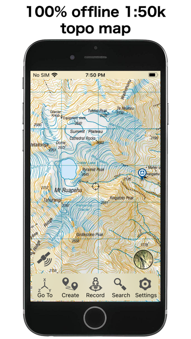
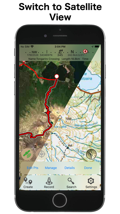
This app provides complete offline topographic map coverage of the North Island of New Zealand from the LINZ Topo50 1:50k scale map series. The maps are all contained in the installation so there is no additional need for downloads, no need for phone or wifi signal, no slow server issues, no account signups, no missing tiles, and no additional map fees. Just install for seamless off-line zooming and panning across the whole island down to 1:50k scale. The app also includes built in 1:50k resolution satellite images and elevation data. Additional aerial imagery and vector map can be downloaded.
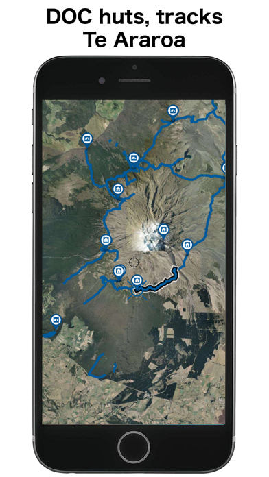
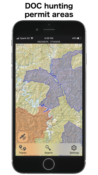
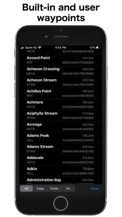
Other integrated data includes DOC hunting permit boundaries, DOC huts, campgrounds, and tracks, Te Araroa trails, Public Conservation Land boundaries, selected public road parcels, weather forecasts, and many others.
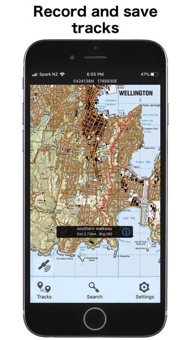
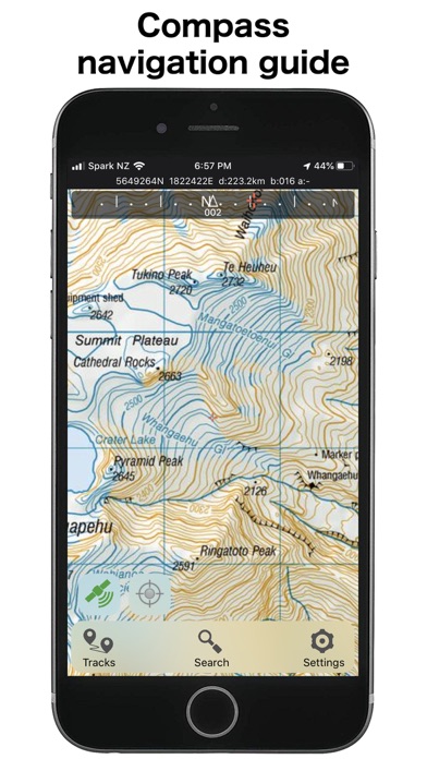
The app has a full suite of navigation functions including GPS location, compass orientation, distance to map locations, track recording and graphing, route creation and following, slope angle and hillshade overlays, import/export of gpx and kml files, search functions for named places and user data. Add and edit your own locations and routes and plot elevation profiles. Set proximity alarms. Share your location. Use your camera view to identify surrounding peaks and match with local topography. Uses an intuitive simple interface with one-touch access to all functions.
LINZ TOPO250 series maps are used at lower zoom levels for easier navigation.
Perfect for outback use out of cell phone range. GPS and maps function fully without phone coverage. No need to cache files in advance either as they are all fully installed with the app. Popular with trampers, hikers, runners, bikers, search and rescue (SAR), hunters, boaters, flying, paragliding, as well as survey applications.
Note that continuous use of GPS will run down the battery faster than when not using the GPS. The NZTopo50 app gives you full control over when GPS is used. The map can be used without GPS, intermittently with GPS for spot checking of location, continuously for logging while the app is open, or for continuous background logging when the phone is off.
Check our website for links to user guides and useful tips and tricks.
The in-app purchases are for an optional contribution to ongoing app development, or for selected additional third party data sets. They don't affect the functionality of the app or the availability of updates.
Feel free to get in touch with any suggestions.
Other integrated data includes DOC hunting permit boundaries, DOC huts, campgrounds, and tracks, Te Araroa trails, Public Conservation Land boundaries, selected public road parcels, weather forecasts, and many others.
The app has a full suite of navigation functions including GPS location, compass orientation, distance to map locations, track recording and graphing, route creation and following, slope angle and hillshade overlays, import/export of gpx and kml files, search functions for named places and user data. Add and edit your own locations and routes and plot elevation profiles. Set proximity alarms. Share your location. Use your camera view to identify surrounding peaks and match with local topography. Uses an intuitive simple interface with one-touch access to all functions.
LINZ TOPO250 series maps are used at lower zoom levels for easier navigation.
Perfect for outback use out of cell phone range. GPS and maps function fully without phone coverage. No need to cache files in advance either as they are all fully installed with the app. Popular with trampers, hikers, runners, bikers, search and rescue (SAR), hunters, boaters, flying, paragliding, as well as survey applications.
Note that continuous use of GPS will run down the battery faster than when not using the GPS. The NZTopo50 app gives you full control over when GPS is used. The map can be used without GPS, intermittently with GPS for spot checking of location, continuously for logging while the app is open, or for continuous background logging when the phone is off.
Check our website for links to user guides and useful tips and tricks.
The in-app purchases are for an optional contribution to ongoing app development, or for selected additional third party data sets. They don't affect the functionality of the app or the availability of updates.
Feel free to get in touch with any suggestions.
Details
| Developer | Right Place Resources |
|---|---|
| Category | Navigation |
| Price | € 3,99 |
| Age rating | 4+ |
| Version | 6.04.03 |
| Size | 2.2 GB |
| Minimum iOS | 16.6 |
| Bundle ID | sqrl.net.NZTopo50.NI |
| Released | 2013-02-20 |
| Last updated | 2026-09-05 |
| Languages | 1 languages |
What this page answers
- NZ Topo50 North Island app reviews
- NZ Topo50 North Island app rating
- NZ Topo50 North Island download
- NZ Topo50 North Island app store rank
- NZ Topo50 North Island reviews
- NZ Topo50 North Island reviews and ratings
- is NZ Topo50 North Island legit
- is NZ Topo50 North Island a scam
- NZ Topo50 North Island real user reviews
- NZ Topo50 North Island rating
- NZ Topo50 North Island complaints
- what people say about NZ Topo50 North Island
- NZ Topo50 North Island pros and cons
- NZ Topo50 North Island experience
- should I trust NZ Topo50 North Island
- NZ Topo50 North Island feedback
- NZ Topo50 North Island review 2026
- NZ Topo50 North Island check
- NZ Topo50 North Island safety check
- reviews about NZ Topo50 North Island
